Best models by use case
-
Best overall: DJI Matrice 350 RTK. It is the safest all-purpose pick for serious surveying because it combines long flight time, rugged weather resistance, and payload flexibility.
-
Best value: DJI Mavic 3 Enterprise RTK. It offers a strong mix of portability, mapping quality, and affordability compared with bigger enterprise drones.
-
Best for LiDAR: DJI Matrice 400 + Zenmuse L3. It is the clearest choice when the project depends on dense point clouds and survey-grade 3D capture.
-
Best for large acreage: WingtraOne GEN II / Wingtra Ray and senseFly eBee X. Fixed-wing or VTOL fixed-wing designs are better when coverage matters more than hovering.
Review highlights
-
Positive reviews consistently mention accuracy, RTK support, flight stability, and payload flexibility on the premium platforms. Teams also praise the Mavic 3 Enterprise and Phantom 4 RTK for dependable survey workflows.
-
Negative reviews usually focus on high purchase price, training complexity, and limited portability for larger drones. Fixed-wing models are also criticized when crews need easy takeoff, landing, and tight-space operations.
-
For budget-conscious buyers, the tradeoff is usually between lower upfront cost and fewer enterprise features, especially when compared with Matrice-class platforms.
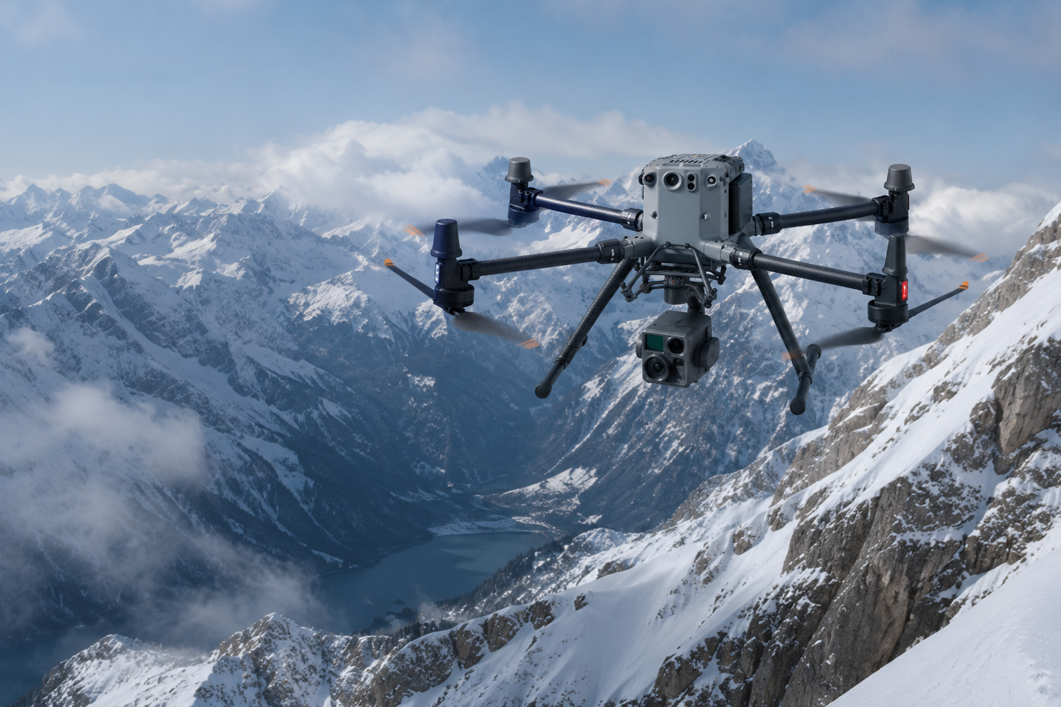
DJI Matrice 400 with Zenmuse L3: Survey Drone Review
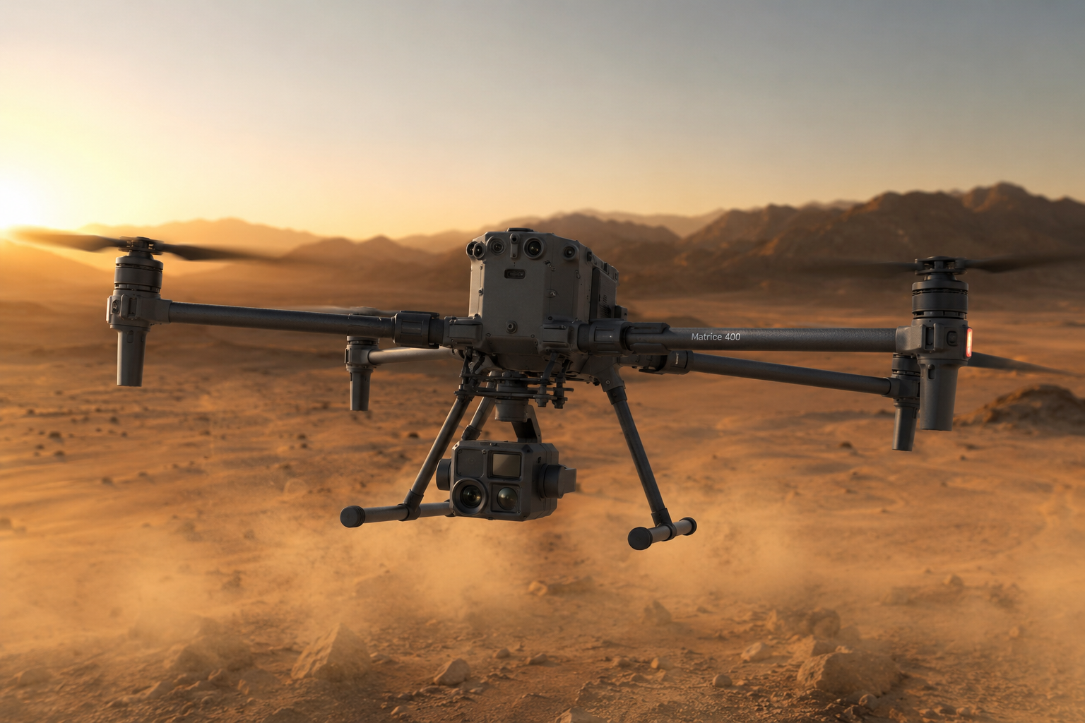
The DJI Matrice 400 paired with the Zenmuse L3 is an enterprise-grade surveying system built for LiDAR mapping, large-area photogrammetry, and demanding inspection work. DJI describes the M400 as a flagship platform with up to 59 minutes of flight time and up to 6 kg payload capacity, while the L3 adds long-range LiDAR and dual 100MP RGB cameras for geospatial capture.[enterprise.dji]
Star Rating
4.8/5
I’m rating it this highly because the platform is extremely capable for professional survey work, but it is also expensive and clearly aimed at specialized teams rather than general users.[enterprise.dji]
Quick Verdict
The DJI Matrice 400 with Zenmuse L3 is one of the strongest options for professional drone surveying in 2026. It combines long flight endurance, enterprise safety features, and advanced LiDAR/RGB payload capability in one system.[dji]
What Users Like
A Reddit UAV mapping discussion praised the M400 for its 59-minute payload flight time, 6 kg payload capacity, improved transmission range, and LiDAR/mmWave-based obstacle avoidance, especially for powerline work.[reddit]
That same discussion also highlighted the new battery system and hot-swap support, which is a practical advantage for field operations where downtime matters.[reddit]
A separate review article on the Zenmuse L3 said the feature set is impressive, and noted that the payload’s range and sensing options are the kind of upgrades that matter for serious survey work.[dronexl]
What Users Dislike
The main complaint repeated in the review coverage is cost. The DroneXL piece explicitly says the reviewer’s “main complaint would be the cost,” and describes the price as steep for a software/license-like purchase.[dronexl]
Community comments also suggest that some users see the M400’s advanced automation and safety features as unnecessary for simpler photogrammetry workflows, especially when the mission does not require heavy obstacle sensing.[reddit]
In practical terms, that means the system can feel overbuilt if someone only needs basic mapping or smaller site documentation.[enterprise.dji]
Direct Feedback
Here are the most useful direct comments found from community and review sources:
-
“The flight duration has increased to 59 minutes while carrying a payload.”[reddit]
-
“Advanced obstacle avoidance is facilitated by LiDAR and Millimeter Wave Radar, which is particularly effective for detecting powerlines.”[reddit]
-
“My main complaint would be the cost.”[dronexl]
-
“The range story is just a single number on paper.”[dronexl]
-
“The M400 provides the flight stability and endurance required for controlled, repeatable data capture.”[linkedin]
Specs
Pros
-
Strong endurance for long survey missions.[enterprise.dji]
-
High payload capacity for enterprise sensors.[dji]
-
LiDAR and radar improve safety in complex environments.[dji]
-
Zenmuse L3 adds long-range LiDAR plus high-resolution RGB capture.[enterprise.dji]
-
Good fit for repeatable professional mapping workflows.[linkedin]
Cons
-
Expensive compared with smaller mapping drones.[dronexl]
-
More complex than entry-level survey platforms.[enterprise.dji]
-
Likely overkill for basic photogrammetry work.[reddit]
-
The payload ecosystem is powerful, but that also makes buying decisions harder.[reddit]
Best For
This setup is best for survey firms, infrastructure teams, powerline inspectors, and geospatial specialists who need a single platform for LiDAR and RGB deliverables. It is especially strong when mission reliability and data density matter more than low purchase price.[enterprise.dji]
FAQ
Is the DJI Matrice 400 good for surveying?
Yes. DJI positions it as an enterprise flagship drone with high endurance, strong payload support, and advanced sensing for demanding professional missions.[dji]
Is Zenmuse L3 good for LiDAR mapping?
Yes. DJI describes Zenmuse L3 as a next-generation high-accuracy aerial LiDAR system with long-range capability, dual 100MP RGB cameras, and high-precision positioning support.[enterprise.dji]
Is it worth the price?
It is worth the price only if you need professional-grade survey performance, LiDAR delivery quality, and enterprise-level flight capabilities. Review feedback consistently points to cost as the biggest drawback.[dronexl]
Manufacturer Link
Official DJI Enterprise page: DJI Matrice 400[enterprise.dji].
DJI Matrice 350 RTK: Survey Drone Review
The DJI Matrice 350 RTK is a flagship enterprise drone designed for surveying, inspection, mapping, and public safety missions. DJI describes it as a platform with upgraded video transmission, a more efficient battery system, stronger safety features, and broad payload expansion options.
Star Rating
4.8/5
This score reflects the Matrice 350 RTK’s excellent professional performance, long flight time, and flexible payload support, with the main downside being its high price and enterprise-focused workflow.
Quick Verdict
If you need a dependable survey drone for serious work, the Matrice 350 RTK is one of the best platforms in its class. It is especially strong for teams that need RTK accuracy, long endurance, and compatibility with multiple payloads.
What Users Like
A review video calls the Matrice 350 RTK a “powerful and efficient” drone and says it benefits from feedback learned from the Matrice 300 RTK generation.
DJI’s own product page highlights improved transmission, better battery management, more safety features, and robust payload capability, which are the core reasons many professional operators prefer it.
The spec sheets also show why it is attractive for survey work: up to 55 minutes of max flight time, IP55 protection, RTK positioning accuracy, and support for survey mission types like waypoint, mapping, oblique, and linear flights.
What Users Dislike
The biggest complaint is price. One review says the drone is impressive, but that “the price is rough,” which matches the reality that this is an enterprise platform rather than a budget survey drone.
Another limitation is payload capacity relative to some larger industrial systems. The Matrice 350 RTK supports up to 2.7 kg max payload, which is excellent for many survey sensors but still less than heavy-lift platforms.
Direct Feedback
Here are the strongest direct feedback points from the sources:
-
“Powerful and efficient DJI M350 RTK.”
-
“A New Industry Benchmark.”
-
“After 3 years atop the commercial drone industry and multiple feedback from our end users.”
-
“The price is rough.”
-
“Matrice 350 RTK sets a new benchmark in the world of commercial drones.”
Specs
Pros
-
Strong RTK accuracy for surveying.
-
Long flight time for a workhorse enterprise drone.
-
IP55 rating improves reliability in tougher conditions.
-
Flexible mission support for mapping and inspection.
-
Strong payload ecosystem for enterprise sensors.
Cons
-
Expensive compared with prosumer drones.
-
Payload capacity is limited compared with heavy-lift alternatives.
-
Enterprise setup and workflows may be more complex for smaller teams.
-
Not a casual-use drone.
Best For
The Matrice 350 RTK is best for survey companies, inspection teams, public safety crews, and professionals who need reliable RTK performance and payload flexibility. It is especially useful when mission quality matters more than keeping purchase cost low.
Manufacturer Link
Official DJI Enterprise page: DJI Matrice 350 RTK
Leave a Reply